About the Open Space World Map
Provided by Michael M Pannwitz
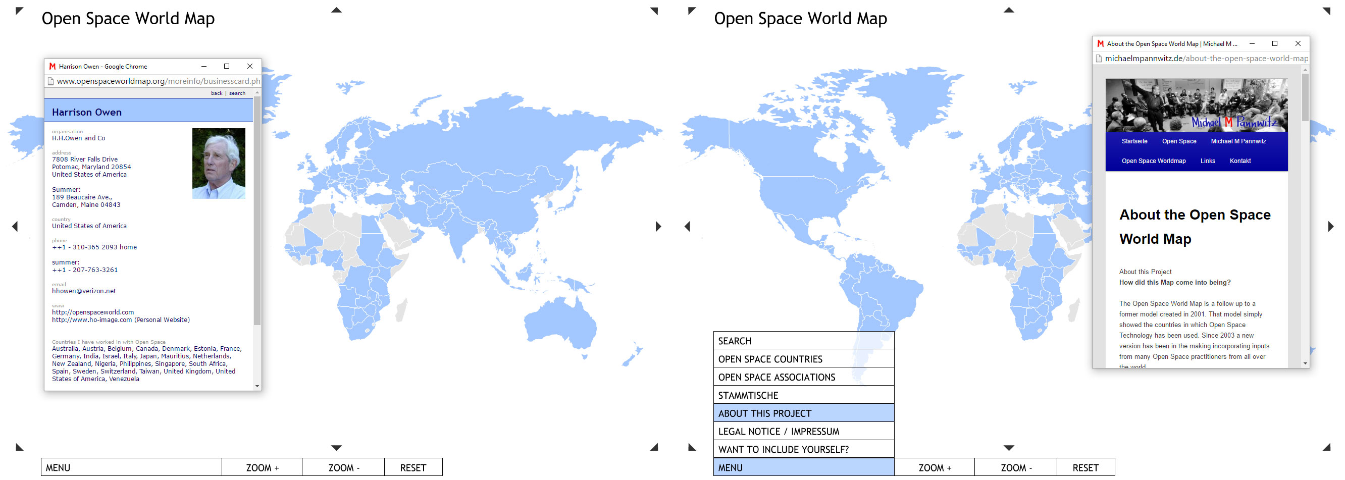
Created in 2001 - Evolving Ever Since
The Open Space World Map was created in 2001.
In its first version, the Map showed that Open Space Technology was used in all kinds of cultural, political and economic settings in countries all over planet Earth.
The second version, launched in 2004, allowed Open Space workers to include themselves in the Map, along with their contact information.
A year later, 310 Open Space workers from 57 countries had done so.
Now the Map is populated by 539 Open Space Workers active in 145 countries worldwide.
In 2015 the Map comprised more than 400 Open Space workers in over 140 countries. In addition to their contact details, links to more than 200 web sites were posted here, providing a window into the broad spectrum of the practice of Open Space worldwide.
2016 – The Third Version
The 2016 version continues to track the spread of Open Space Technology and Open Space workers around the world.
The new version
- contains a content management system that enables you to enter and manage your personal contact details yourself
- highlights the countries where Open Space Technology is being used (earthen color) and indicates, next to the country name, how many resident Open Space workers are included for that country (countries with no reported Open Space activities are shown in white)
- displays the names of the countries as you move the cursor over the Map
- allows you to click on a country to view an alphabetical list of its resident Open Space workers as well as further information for that country (want to add a General Link for your country? Send an email to the provider of the World Map)
- provides a self-managed “info box” to everyone inluded in the Map - for contact details, a photo, links and additional information
- provides a link to the Open Space worldscape database (managed by Jo Töpfer) for those who have posted details there on Open Space events they have facilitated or are going to facilitate
- offers a “search” function
- can be zoomed in and out
Financial Contributions
Operating costs are covered by contributions from those who have included themselves in the Map.
The suggested initial contribution is 35€. The suggested annual contribution is 10€.
Once a year, everyone in the Map except "Lifelong Member" receives an invitation to contribute.
As in the past, anyone can become a "Lifelong Member" by making a one-time contribution of 100€.
Contributions are needed to fund the Open Space World Map. However, they aren't a prerequisite for inclusion.
Here you can go directly to the information on making a financial contribution.
Surplus
Surplus funds are kept in a "Revolving Credit Fund" for activities promoting the spread of Open Space Technology (OST) worldwide.
Zero-interest loans and grants are available to support
- attendance of Open Space on Open Space (OSonOS) gatherings at local, regional and worldwide (WOSonOS) levels
- participation in OST Trainings and Open Space workshops
- the publication of books and materials on OST and closely related subjects
- other emerging activities to spread OST
Dedication and Thanks
The Open Space World Map is dedicated to Harrison Owen, who “discovered” Open Space Technology and then proceeded to give it away, with just one string attached: “Share your learning!”
Thanks to all of you who have devoted your passion and skills to developing and maintaining the Map from 2001 right up to its current version… especially to Daniel Pannwitz, Johannes Scholl, Luca Marzano and Michael Siebert and Michael Dills.